Lake Lagunias Loop

Follow Marin Events

• HomeUpPantoll down to StinsonInvernessBootjack TrailsPine Mountain in FairfaxGGNRAHamilton  WetlandsHeadlandsLake Bon TempeLake Lagunias LoopAbove Lake Lagunitas, FairfaxMount Tamalpais North East Peak loopMount Tamalpais South East Peak loopMountain Theatre HikeMuddy Hollow  to Limantour BeachMuir Woods without the crowdsPine Mountain in FairfaxRedwoods in NovatoRoy’s Redwoods - Nicasio Valley RoadRush Creek BahiaRush Creek Fire RoadShady Loop on Mount TamalpaisTomales Bay, shade and Shell BeachSunset BeachSamuel P. Taylor’s cool loop through RedwoodsPanoramic, Canopy View, Muir WoodsCosta RicaTerra Linda/Sleepy Hollow PreserveSan Pedro Mt. ( edge of China Camp)Jenner Sea to Sky Raptor Ridge loop •
•  •

Lake Lagunitas loop

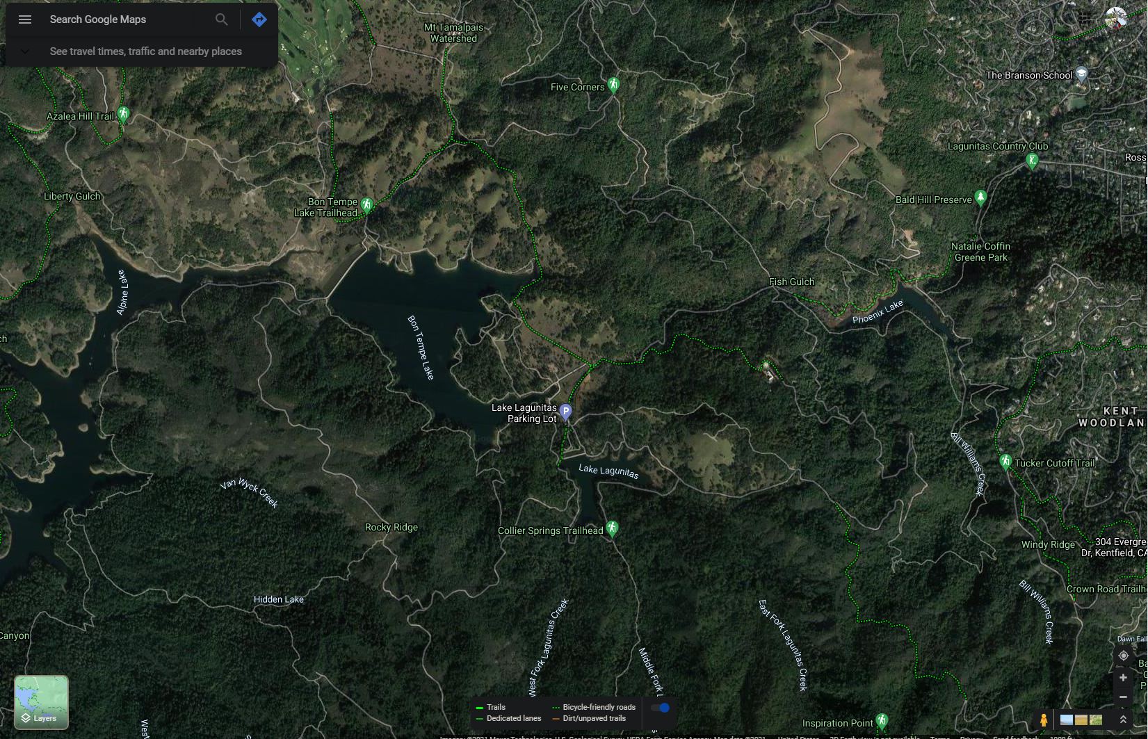
Celebrate holiday family time with a one-mile loop around Lake Lagunitas in the Marin Municipal Water District land outside Fairfax. The scenic hike has views of Mount Tamalpais and is a walk that preschoolers, elders and even the family pooch (on leash) can enjoy together. You could even manage a stroller though you’d have to lift or carry it in a few spots.

From the parking lot, walk uphill about 1/10 of a mile to the dam. Lake Lagunitas is the oldest of Marin’s reservoirs, built by William Coleman, a water entrepreneur, before MMWD was formed. The earthen dam, built in 1873 by Chinese laborers, was the third-largest dam in California. The lake held 150,000 gallons and was designed as a gravity feed system. At the time it was Marin’s only reservoir. Since the 1960s the water from Lake Lagunitas is only used in times of drought.

One bird you are likely to see is the pied-billed grebe, which some might mistake for a diving duck. Grebes have webbing around the toes (lobed feet) instead of webbing between the toes like ducks. Their legs are situated far back on their bodies, making them excellent divers but awkward on land. They are the only grebe that will nest on Lake Lagunitas as other grebes are mainly winter residents in Marin. Nests are anchored to reeds in a way that allows them to move if water level changes. Tell the kids that mama grebes carry their babies on their backs, giving them a “grebey-back” ride.


Turn right and cross the dam. At the far end, there is an area of cattails. Many indigenous people used the starchy roots of cattails for food. The fluffy absorbent seeds were used for babies’ bedding. The fire road turns left, under black oaks and Douglas firs.

One mushroom you are likely to see is the Douglas fir suillus. it has a mycorhyzal relationship with Douglas firs, meaning that the mushrooms and trees benefit each other. Unlike the Agaricus mushrooms you buy in the store that have gills, these mushrooms, which are in the same family as porcini, have pores. That means the underside of the mushroom looks like a sponge, in this case a mustard colored sponge. Scratch the side of the stem and wait a minute and it will turn blue-green!

Cross the bridge over Lagunitas Creek and as you approach some redwoods look for an acorn woodpecker granary. Acorn woodpeckers usually store their acorns in trees with soft wood, like pines and Douglas firs. It is less common to see them in redwoods. It’s likely you will see an acorn woodpecker, and you are sure to hear them. Some describe the call as manical laughter and others think they say, “Wake-up, Wake-up!” Xeno-canto.org is an excellent website for listening to bird songs and calls.

At the junction of Lagunitas Road (some maps call it Lagunitas Lake Fire Road) and Lakeview Road, turn left to continue around the lake. A newt crossing sign there by Manor School fourth graders in Laura Honda’s class reads, “Please watch out for the newts. Their survival depends on us.” Honda is a Marin treasure, well known for her environmental education work. She has won many awards, including California science teacher of the year and the Terwilliger Environmental Award for her work in teaching children to be good environmental stewards.

Just before the fire road returns to the dam there are some steps and a sign saying to walk bikes. This is one place a stroller would have to be carried. When you return to the parking lot take time to look at the bulletin board that lists visitor sightings of bobcats, otters and other animals, and to admire the picnic shelter built by the Civilian Conservation Corps during the Depression.

To get to Sky Oaks from Highway 101, take Sir Francis Drake Boulevard to Fairfax. Turn left on Pacheco Avenue and make an immediate right on Broadway. Turn left on Bolinas Road. Go approximately 1½ miles to 700 Bolinas Road where you will see a wooden sign on your left saying “Lake Lagunitas.” Turn left at the sign onto Sky Oaks Road. Pay parking fee at pay station. Park at the end of the paved road.

Wendy Dreskin has led the College of Marin nature/hiking class Meandering in Marin since 1998, and teaches other nature classes for adults and children. To contact her, go to wendydreskin.com.

source
• Pantoll down to StinsonInvernessBootjack TrailsPine Mountain in FairfaxGGNRAHamilton  WetlandsHeadlandsLake Bon TempeLake Lagunias LoopAbove Lake Lagunitas, FairfaxMount Tamalpais North East Peak loopMount Tamalpais South East Peak loopMountain Theatre HikeMuddy Hollow  to Limantour BeachMuir Woods without the crowdsPine Mountain in FairfaxRedwoods in NovatoRoy’s Redwoods - Nicasio Valley RoadRush Creek BahiaRush Creek Fire RoadShady Loop on Mount TamalpaisTomales Bay, shade and Shell BeachSunset BeachSamuel P. Taylor’s cool loop through RedwoodsPanoramic, Canopy View, Muir WoodsCosta RicaTerra Linda/Sleepy Hollow PreserveSan Pedro Mt. ( edge of China Camp)Jenner Sea to Sky Raptor Ridge loop •    
Questions or problems regarding this web site should be directed to Info@marincounty.info  
Last modified: Thursday February 22, 2024.