|
There is a fundamental premise that is erroneous about the
whole concept of Transit Oriented Development (TOD) around the Civic Center
Station. TOD is for commuters that would take the train to work. This
assumes that people will live in Marin and commute to Sonoma. The 16 member
committee thinks there will be 620 commuters to Sonoma living in 5 story
apartments, 400 feet from the freeway (when SMART has asked for only 20
parking spaces to meet their ridership requirement). Does the committee
think they know more than the traffic experts who did extensive studies
costing thousands of $'s calculating ridership?
Commuters won't be commuting from Civic Center to SR or Novato -- they can
drive it in about 1/4 the time they would take by train. Plus that short
trip wouldn't justify the train. And there are no plans for the train to go
to Larkspur ferry.
Clearly at the most this will be an Arrival station for workers at
Civic Center, Autodesk and Northgate. It will
never be a Departure Station.
So what's the point of residential development around it?
Affordable Housing is needed for people working in Marin -- not Sonoma.
Thus Affordable Housing needs to be built AWAY
from Marin stations! |

San Rafael Civic Center Station Area Plan July2012
Recommended Plan: the final
"increase
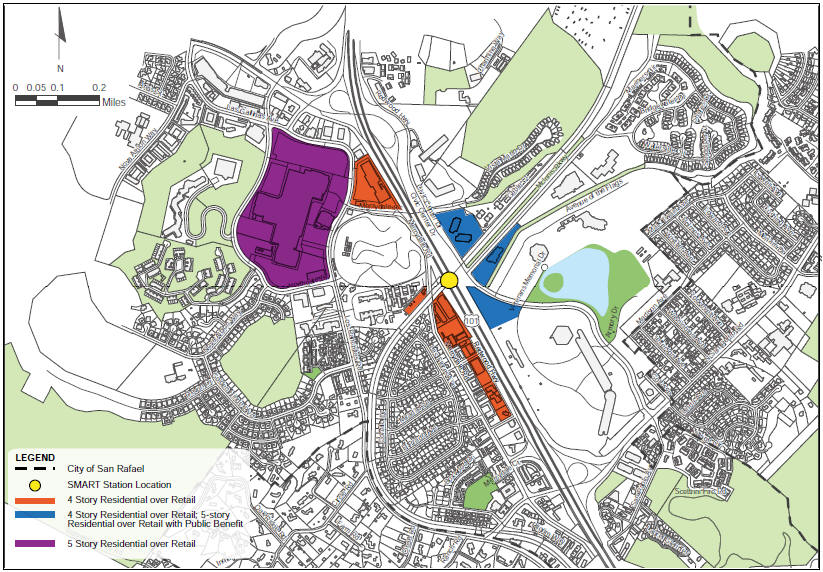
height limits to 4 stories for residential and mixed-use development only.
Allow an additional story (for a total of 5)"
"increases in retail and office
floor area
ratio (FAR)
above 0.30 and increases in residential density above 44 units per acre"
SMART has initially asked for 20 parking spaces and the predicted -
2025 PEAK PERIOD
RIDERSHIP at the CIVIC CENTER is:
- Northbound: 43on 17off
- Southbound: 25on 96off
It was said by staff that in the Gen. Plan, Merrydale could be zoned
for 3 story. That means that for it to be zoned for more requires a Gen.
PLAN AMENDMENT. A totally separate process from this "railroaded"
16-person-committee driven Plan, which didn't include SMART
Ridership Calculation. |
The City Council Meeting Aug
20th 2012 was filled with around 200 objectors to this proposed
development. Although committee members and staff tried to play down this
Plan as just a "Vision", staff were heard to say to council that "a result of acceptance would be corresponding zoning"
of the proposed 4 and 5 story development. McCullough said he
would approve this Plan only if:
- the minutes of the last committee meeting (
which was divided on limiting everything to 3 stories) and
- the minutes of THIS meeting
were included in the final document. This is what they all finally
voted for.
We need to make sure this happens.
Great view of freeway from 4th story
A Plan that would build 4 or 5 story
residential apartments on land currently occupied by Autodesk, and new
Farmers Market site.
That is 150 yards from a freeway.
Asking people to live so close to constant air pollution is not a way of the
future and certainly not Marin's.
|
CHAPTER 5. LAND USE AND URBAN DESIGN
Chapter 4 describes the multi-modal circulation framework and facilities
that will serve the San Rafael Civic Center Study Area and improve
connectivity between existing neighborhoods and to the new SMART Station.
This chapter discusses the land use opportunities and desirable
character of future development and public spaces that can help
realize the community’s vision for the area. It describes
the station area’s existing site conditions, the potential areas appropriate
for new development, and design guidelines that will ensure that new
development supports transit and improves and enhances the surrounding
neighborhoods, without disrupting the special character of the area.
5.1 TRANSIT- ORIENTED DEVELOPMENT
Transit-oriented development is good town planning: it aims
to create an environment that is attractive and provides daily goods and
services in proximity to transit.
The four fundamental components of transit-oriented development are:
• A mix of land uses, such as housing, office, retail and civic uses that
attract people to the area
• Sufficient densities to support transit, services, and retail for the area
• A circulation framework that supports all modes of travel, including
bicycles and pedestrians
• An attractive and safe public environment of streets, sidewalks,
crosswalks, plazas, and other spaces.
Transit-oriented development is supported in this area by the 2005 City of
San Rafael General Plan 2020. The Housing Element of the General Plan
encourages infill near transit, allowing higher densities at transit hubs.
The Neighborhoods Element supports construction of the Civic Center SMART
station and encourages a plan “that provides higher density housing, bus
transit connections, a parking lot, and incorporates pedestrian facilities
and bicycle access . . . “.
 |
5.2 A BALANCED APPROACH
In accommodating any transit-oriented development in existing
districts, it is important to take a balanced approach that is sensitive to
existing conditions and current policies. Therefore, in the Civic Center
Station Area, the underlying principles of this study are to:
• set a sound but flexible framework of land use, circulation and transit
facilities that will serve the area well for many years,
• respect current policies and regulations that have been discussed and
developed with local community involvement and that contribute to the
livability of the area,
• at the same time recognize that over time there may be a gradual change of
use and density in the Study Area to those that are compatible with a
balanced, transit-oriented neighborhood, and that this Plan should guide
that change appropriately,
• protect and enhance the special character of the area, including the
residential neighborhoods and open space resources.

There are opportunities within the Civic Center Station Area to support
more transit-supportive development, either through the development of
existing parking lots, storage, or strip-commercial sites or through the
long-term conversion of existing underutilized sites to higher,
transit-supportive densities and uses.
5.3 AFFORDABLE HOUSING
The City of San Rafael has a longstanding commitment to affordable
housing, as reflected in policies included in General Plan 2020’s Housing
Element and Section 14.16.030 Affordable Housing Requirements of the Zoning
Ordinance. These policies identify affordable housing as a vital community
need. The City has developed policies and programs to produce affordable
units by requiring new residential development to include affordable units
and for new job-producing commercial development to contribute financially
to affordable housing programs. With the residential, retail, and commercial
development that could occur within close proximity to the station,
increases to the City’s affordable housing stock could occur. This Plan
supports and includes those affordable housing provisions.
5.4 TRAFFIC CAPACITY
The capacities of area streets and intersections are among the primary
constraints to any future development in the Study Area. The San Rafael
General Plan 2020 evaluated traffic capacities based on existing and planned
circulation improvements. Subsequent analysis conducted by the City for this
project confirmed that even with the construction of the traffic
improvements identified in the General Plan, the Study Area can accommodate
only the growth already assumed in the General Plan. The General Plan-
projected increase in residential units, office, and retail uses over that
existing within the three geographic portions of the study area are shown in
Table 3 below. Traffic improvements over those identified in General Plan
2020 are not proposed by this plan, so the total amount of development
assumed will not exceed the General Plan assumptions in Table 3. While the
assumed amount and general location of development cannot change, it has
been directed and focused by the provisions of this Plan.
|
TABLE 3
GENERAL PLAN 2020 ASSUMED LAND USE CAPACITY |
|
Planning Areas |
Residential
(Dwelling Units) |
Office
(Square Feet) |
Retail
(Square Feet) |
|
East of US 101 Area |
200 |
200,000 |
0 |
|
Redwood Highway Area |
100 |
0 |
0 |
|
Northgate Area |
320 |
0 |
80,000 |
|
Source: City of San Rafael. |
5.5 REGULATORY CONSIDERATIONS
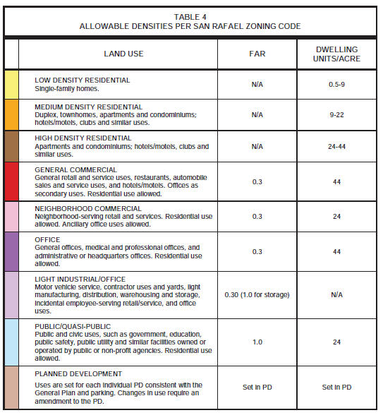
Table 4 summarizes the allowable densities of development set by city
zoning regulations and the General Plan throughout the City including the
Study Area. Figure 16 shows the zoning designations on properties within the
Study Area. Allowable residential densities are determined by the number of
dwelling units allowed per acre of land. The intensity of office or retail
development allowed is based on a floor area ratio (FAR), the ratio of total
building development (in square feet) to total site area. In mixed-use
districts, where both residential and commercial uses are allowed, allowable
development intensity is determined by combining the floor-area-ratio (FAR)
for the non-residential component, with the minimum lot area required per
dwelling unit for the residential component. For purposes of clarity,
minimum lot area per dwelling unit has been converted to dwelling units per
acre (dus/ac).
5.6 LAND USE CONCEPTS
The goal of this Plan is to “set the stage for creating a vibrant,
mixed-use, livable area supported by a mix of transit opportunities,
including passenger rail service.” Several overarching principles were
established by the Committee to ensure that the Civic Center Station Area
achieves its goals, while also preserving the existing neighborhood
character. These include the following:
• Protect the existing residential neighborhoods from adverse impacts of new
development
• Allow new residential, office and mixed-use development that is both in
scale with the existing neighborhoods and is complementary to the community
character
• Provide safe and attractive transit access for all modes of transportation
• Encourage mixed-use development to accommodate additional small businesses
that provide local neighborhood services and amenities.
The Committee also articulated overall land use considerations that have, in
turn, informed the specific land use recommendations that follow. The
considerations include the following:
1. In general, multi-family residential buildings should be encouraged
within walking distance of the station (generally within ¼ mile). This is a
long range plan, looking 25 years into the future, and major alterations in
uses could occur that are not currently contemplated. Market considerations
will ultimately determine what uses are feasible and when.
2. While policies should emphasize residential development, increases in
both residential and commercial intensities are encouraged in the immediate
vicinity / within walking distance of the station. This pattern of uses can
help achieve lessened reliance on single occupancy vehicles. It can also aid
in the enhancement of the station area as a center of activity and community
resource. With development that is focused and clustered around the freeway
and train station, the existing residential neighborhood character will be
protected. The conversion of existing commercial buildings to residential
uses could also increase residential development.
3. There does not appear to be market demand to support significant
additional general purpose retail in the area. Limited station-related
retail should be allowed in proximity to the station. Additional
neighborhood-serving retail should be allowed, but not required, in areas
that are appropriate for mixed-use development.
4. Higher densities demand greater attention to high quality design. Where
height limits are increased, architectural quality becomes essential. Within
close proximity to the freeway, care should be taken to maintain occupant
safety and health are maintained. Further, environmental considerations are
always important, especially attention to the area’s creeks and wetlands.
The vision for the Study Area is further refined with recommendations
specific to three geographic zones, each of which has unique characteristics
and opportunities:
• East of US 101 Area
• Redwood Highway Area
• Northgate Area.
A more detailed discussion of recommendations for each of these three zones
is provided below. The zones are illustrated in Figure 17.

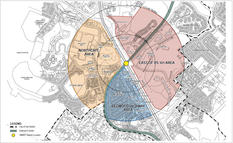
Not to Scale SF10-0507 San Rafael Civic Center
SAP\Deliverables\Station Area Plan Report\Graphics_Final_Report
PLANNING AREAS FIGURE 17
5.7 EAST OF US 101 AREA
The East of US 101 area generally encompasses all uses east of the
freeway, including the Civic Center.
5.7.1 Existing Conditions
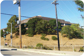
East of US 101, the Study Area is dominated by the Marin County Civic
Center, which includes the Hall of Justice, Administration Building, Armory,
General Services Building, Memorial Auditorium, and Exhibit Hall.
Encompassing about 128 acres, 90 of these are open space and include the
Lagoon and Lagoon Park. Parking lots define the edges of the site,
especially on the west along the US 101 right-of-way and along Avenue of the
Flags north of the lagoon. North of the Civic Center along McInnis Parkway
are located a commercial office building and an Embassy Suites hotel.
Further east lies an 3900 Civic Center Drive office building and Marin
Lagoon, a residential neighborhood. North of the rail tracks, which parallel
McInnis Parkway, the hillsides accommodate a range of uses including an 3900
Civic Center Drive office building, the Sutter Terra Linda Urgent Care
facility, medical offices, and the Vista Marin residential development which
faces the Civic Center. A mix of smaller office and multi-family residential
uses lie further north along Redwood Highway and beyond the Study Area. The
freeway right-of-way presents a major barrier between this area and the
areas to the west. At the station, where the freeway overpass is elevated,
it creates not only a physical barrier, but also a visual one.
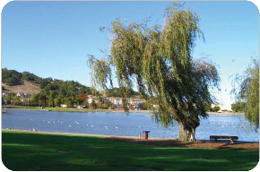
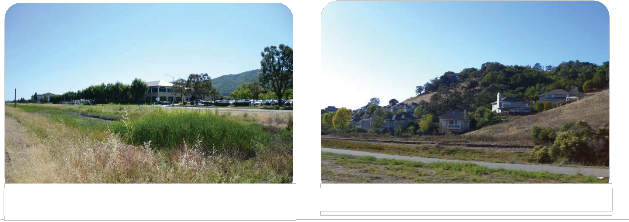

Lagoon Park at the Marin County Civic Center

Sutter Terra Linda Urgent Care Facility
McInnis Parkway, with wetlands in foreground and office and
hotel uses beyond
Vista Marin residential neighborhood
5.7.2 General Plan and Zoning
The General Plan designates various sites in the study area as suitable
for public use (the Civic Center), office (e.g., 3900 Civic Center Drive),
general commercial (the hotel), and various residential types. All of the
properties that lie along McInnis Parkway are zoned as Planned Development
parcels and contain site specific land uses. All of the office zoned
properties have a maximum allowable FAR of 0.3 and are also permitted to
include residential uses, although this mix of uses has never been
implemented. A majority of the area has an overlay zone of Hillside,
Wetlands or both, where specific General Plan and zoning permissions apply
to protect these natural resources. The building height limit in the area is
36 feet, except on hillside sites. Zoning uses and densities are shown on
Table 4 and existing zoning is shown on Figure 16.
5.7.3 Opportunities
This Plan concludes that sites along McInnis Parkway in close proximity
to the station (within ¼ mile or easy walking distance) that currently
include office or hotel uses could, in the long run, be developed at
somewhat higher densities and heights and could also include new housing.
The level properties along Civic Center Drive within walking distance of the
Station are also possible locations for more intense development. This Plan
acknowledges the County Plan for the Marin County Civic Center, but also
notes that the vacant County site adjacent to the station, also known as the
Christmas tree lot, presents an opportunity for a transit-oriented project
since it is large, close to the station and vacant. Any housing on the Civic
Center Drive hilltop sites must include improvements that facilitate access
to the Station, including pedestrian improvements to address the perceived
barrier of the uphill climb from the station to the site.
Housing or mixed-use on these development sites could be 4 stories, and must
be designed with sensitivity to the scale and layout of existing residential
neighborhood and to the nearby creeks and wetlands, views to the surrounding
hills, and the visual character of the County Government Center. An
additional 5th story could be added where a
significant public benefit is provided in the Planning Area. Public benefit
could be items such as additional affordable housing, additional creek
improvements,
public plazas, or other amenities.
5.7.4 Recommendation
In order to achieve the vision for the area, focused increases in height
limits, allowable FAR and/or residential densities would be required. The
actions necessary to support the vision of the East of US 101
Area include the following:
• In the current office and commercial areas, investigate and implement
increases in retail and office FAR above 0.30 and increases in residential
density above 44 units per acre within the identified limits of traffic
capacity. Amend the General Plan and zoning designations on PD zoned lots to
allow residential use.
• Density increases can be higher on the level lots (MCERA APN 180-410-06;
3900 Civic Center Drive parking APN 180-124-06), than on the more distant
flat lots or on the hillside lots.
• The Christmas tree lot is under County jurisdiction, and in addition, any
development that exceeds
250 sq. ft. in building area requires a two-thirds countywide vote. If
changes to the existing master plan are contemplated in the future, density
and FAR increases to the same level as the (MCERA APN 180-410-06 and 3900
Civic Center Drive parking APN 180-124-06), are appropriate.
• On development sites close to the station, amend the General Plan and
zoning to increase height limits to 4 stories for residential and mixed-use
development only, subject to design requirements. Allow an additional story
(for a total of 5) for developments that propose a significant local benefit
or amenity in the Planning Area. Public benefit could be items such as
additional affordable housing, additional creek improvements, public plazas
or other amenities.
• Develop design guidelines that specifically address:
o Consideration of views from the hillside
residences
o Establishment of view corridors along
Avenue of the Flags to the hills, Mt. Tam and the
Frank Lloyd Wright designed Civic Center
o Height step-backs and buffers from
single-family neighborhoods
o Continuation of the City’s creek and
wetlands policies.
5.8 REDWOOD HIGHWAY AREA
5.8.1 Existing Conditions
The Redwood Highway Area is characterized by single-family residential
neighborhoods with some parcels providing commercial uses and multi-family
housing. The Redwood Highway frontage paralleling US 101 is lined with uses
which utilize the freeway visibility, such as a McDonalds and Chevron gas
station, as well as restaurants and home improvement retail outlets.
Merrydale Road is largely fronted by multi-family apartments between North
San Pedro and El Prado Avenue. Some senior housing is also located along
this extent of Merrydale Road. North of El Prado the street has multi-family
units on the east and backyards of homes in the Rafael Meadows neighborhood
on the west. At the north end of Merrydale Road lies the larger sites of
Marin Ventures, a local community services organization, and a Public
Storage self-service facility. A branch of the Gallinas Creek south fork and
parking strip on the west side of Merrydale Road partially separate the
Rafael Meadows neighborhood from the taller multi-family buildings. The
newer Redwood Village planned development lies south of Rafael Meadows and
includes single-family homes as well as townhouses and a public park.
The freeway right-of-way and the rail corridor create significant barriers
in this area, limiting movement by all modes of travel, making easy access
to amenities, services and recreation resources difficult. The freeway,
where it is elevated, also blocks views to the east.

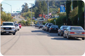
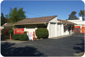
Redwood Highway frontage road Public Storage on Merrydale
Road
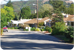
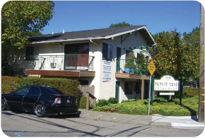
Multi-family housing on Merrydale Road Rafael Meadows
residential neighborhood
5.8.2 General Plan and Zoning
Allowed uses in this area include single-family and multi-family
residential uses, and commercial uses, as well as several planned
development areas. The single-family neighborhood, Rafael Meadows, is zoned
low density residential, with a maximum of 9 dus/ac. The multi-family
residential uses, generally located along Merrydale Road, are zoned
high-density residential, and have a maximum of 44 dus/ac. The commercial
uses along Redwood Highway have an FAR of 0.30. The building height limit in
the area is 36 feet, except in the single-family Rafael Meadows
neighborhood, where it is 30 feet. Zoning uses and densities are shown on
Table 4 and existing zoning on Figure 16.
5.8.3 Opportunities
This plan recommends that all single-family areas should remain as such
and be buffered from new development. Multi-family housing should be
encouraged on the properties closest to the Station, specifically Northgate
Storage, Public Storage, and Marin Ventures. These nearby lots could also
contain small amounts of station serving retail, such as a coffee shop,
convenience store or cleaners, clustered

near the station. Development should be allowed up to 4 stories, except
along Merrydale Road, facing the Rafael Meadows neighborhood, where the 3
stories would be more appropriate. Development in this area would need
to ensure that building articulation, massing, and setbacks provide an
appropriate transition to the single family neighborhood.
The Committee reached consensus on the Draft Plan to include the italicized
text above. After hearing the public comments on the Draft, the Committee
was not able to reach consensus on heights for the Redwood Highway frontage,
the Marin Ventures site, or either storage lot parcel, and were evenly
divided between a No Change Alternative and a Four-Story Alternative.
The area south of the station along Merrydale Road and Redwood Highway is an
appropriate place for mixed-use developments with retail below residential
units.
5.8.4 Recommendation
The General Plan and zoning generally supports the future vision for the
Redwood Highway Area, with the exception of building heights in certain
areas and the use specific regulations on the Planned Development zoned
sites. No changes are proposed for single family areas. The Plan also
recommends the establishment of design guidelines for the area. The
following measures are needed to complete the vision for the Redwood Highway
Area.
• On the properties closest to the station, specifically the Public Storage
and Marin Ventures sites, investigate and implement increases in retail and
office FAR above 0.30 and increases in residential density above 44 units
per acre within the identified limits of traffic capacity. Amend the PD
zoning to allow a mix of residential and retail.

• Increase height limits on Redwood Highway to 4 stories where
residential is constructed over ground floor retail.
The Committee reached consensus on the Draft Plan to include the italicized
text above. After hearing the public comments on the Draft, the Committee
was not able to reach consensus on heights for the Redwood Highway frontage,
the Marin Ventures site, or either storage lot parcel, and were evenly
divided between a No Change Alternative and a Four-Story Alternative.
• Develop design guidelines for the Merrydale Road properties to include
height transitions, building articulation and varied setbacks to prevent the
appearance of a solid wall to the adjacent single-family neighborhood.

63
5.9 NORTHGATE AREA
5.9.1 Existing Conditions
The Northgate Area is the commercial heart of North San Rafael. The most
prominent use is Northgate Mall, a large, partially enclosed regional
shopping mall surrounded by surface parking. Auto supply stores, banks,
office buildings and additional retail is located in Northgate III to the
north and east sides of the mall site. Just north of the rail line and the
proposed station are two large land uses: Guide Dogs for the Blind and Mt.
Olivet Cemetery. Both sites are fenced and gated with no through access. A
small storage facility, Northgate Security Storage, is located adjoining
Guide Dogs for the Blind on the west, immediately adjacent to the station.
Direct access from the northern portion of this area to the station is
compromised the large Guide Dogs for the Blind and Mt. Olivet Cemetery
sites. In addition, the strip commercial and shopping mall have large
parking lots fronting their buildings which do not encourage pedestrian
access.
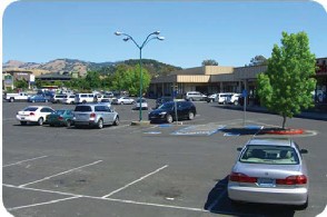
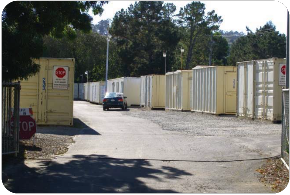
Northgate Security Storage on Merrydale Northgate III
shopping center on Los
Road just north of the station Ranchitos Road across from
Northgate Mall
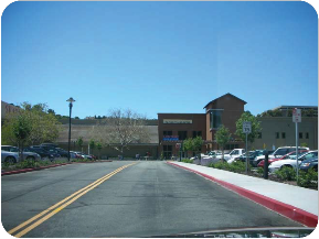
Northgate Mall viewed from Los Ranchitos Road

5.9.2 General Plan and Zoning
Zoning in this area consists mostly of commercial and office uses, as
well as public/quasi-public for the Guide Dogs and cemetery sites. The
storage site adjacent to the station is zoned industrial. All use areas
allow residential uses with the exception of the industrially-zoned storage
site. The office and commercial uses have an allowable FAR of 0.30; they
allow multi-family residential in a mixed-use configuration with a maximum
density of 44 dus/ac. The building height limit in the area is 36 feet.
Zoning uses and densities are shown on Table 4 and existing zoning on Figure
16.
5.9.3 Opportunities
Multi-family residential should be encouraged at Northgate Mall and
allowed to develop up to 5 stories. Multi-family residential and commercial
mixed-use should be encouraged on the Northgate III site at 4 stories. As
discussed in the Station Access and Connectivity chapter, this site should
also accommodate an extension of the Promenade to facilitate pedestrian
access to the Station. Housing, while permitted, is not encouraged in the
office area along Las Gallinas across from Northgate Mall. This stretch is
well suited to its current office and convenience-oriented commercial uses.
5.9.4 Recommendation
In order to achieve the vision for the area, increases to height limits,
FAR and residential densities in focused and specific locations would be
required. No changes are proposed for single family neighborhoods. The
actions to support the vision in this area include the following:
• On the properties closest to the station, specifically the Northgate
Storage site and Northgate III, investigate and implement increases in
retail and office FAR above 0.30 and increases in residential density above
44 units per acre within the identified limits of traffic capacity.
• Amend the General Plan and zoning for Northgate III to increase densities
to the levels assigned to the areas within walking distance of the station,
and to allow 4 stories for residential over retail uses.
• Consider the extension of the Promenade through Northgate III in any major
reconstruction of the site.
• Develop design guidelines to buffer height increases from single family
neighborhoods.
• Amend the General Plan and zoning to allow height increases to 5 stories
for residential development at Northgate Mall.
5.10 NATURAL ENVIRONMENT
The existing natural environment of hills, creeks and wetlands are
important and valued resources of the area. Specific reference to these
resources are made in the Vision North San Rafael and in the General Plan
policies and zoning designations. This Plan supports and includes those
natural environment protection provisions.

5.10.1 Natural Environment Actions
• New development should celebrate natural resources.
• Restore and enhance the natural environment by improving and protecting
creeks, wetlands and hillsides as provided in the General Plan and zoning
provisions.
• The Intergovernmental Panel on Climate Change estimates that mean sea
level rise will rise between one and three feet by the end of this century.
A three-foot rise would inundate much of eastern and central San Rafael,
potentially impacting the study area. In accordance with the San Rafael
Climate Change Action Plan, the City will monitor sea level rise and plan
for shoreline defense; develop a program of levee analysis; participate in
Marin County’s regional vulnerability assessment, and prepare a local
vulnerability assessment for San Rafael; and continue to provide emergency
planning and community awareness.
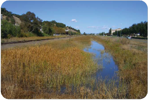
The existing wetland along McInnis Boulevard is attractive
and is a valuable environmental resource.
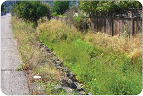
Gallinas Creek is daylit along a portion of Merrydale Road,
and can be restored to provide an attractive amenity for the neighborhood.
5.11 DESIGN GUIDELINES
The existing San Rafael Design Guidelines are intended to promote
“pedestrian-friendly and people- oriented” design in new development. The
guidelines encourage context-sensitive design and design that is in harmony
with existing development. The following guidelines should be considered for
addition to the existing Guidelines.
5.11.1 General Transit-oriented Design Guidelines
Generally, any new development should take the following into
consideration:

66
Street Orientation
Buildings should address the street and sidewalks to create a safe and
pleasant pedestrian environment.
Building Scale and Massing
New buildings should be a reasonable height and scale compared with
adjoining parcels and neighborhoods. Height and scale transitions should be
provided between adjacent buildings where needed.
Building Configuration
New development should have varied and articulated facades to reduce the
apparent size and bulk. Color and materials should also be used to provide
variety and to mitigate scale.
Parking
Minimize parking lots adjacent to the street and sidewalk. Place parking
to the side or rear. Minimize the number of curb cuts for parking lot access
as these can conflict with pedestrian movement. Screen parking from
sidewalks and pedestrian walkways.
Setbacks
Where appropriate, buildings should be located facing the sidewalk with
modest setbacks. A landscaped buffer consistent with that already in the
area should be provided. Large setbacks, as commonly found in business
parks, are not appropriate.
Ground-level Uses
Provide active uses, transparency, public open space, and/or
well-maintained landscaping at the ground level to create interest along the
street and sidewalk, making for a pleasant pedestrian environment.
5.11.2 Specific Building Design Guidelines
Building design guidelines can and should vary somewhat among the three
geographic development areas of the Study Area. Key considerations in these
three areas are as follows.
East of US 101 Area
East of US 101 the development pattern close to the station is dominated
by large structures and parking lots. Although some retail may ultimately be
added, the area is likely to continue to be characterized by larger
buildings, significant parking, and streets providing vehicular, transit,
bicycle and pedestrian access. This area is not likely to become a mixed-use
village, but can become a much more pedestrian- friendly zone.
• Efforts to mitigate the scale of buildings will be important, especially
as it relates to the residential neighborhoods. Design of roofs, façade
materials and the arrangement of building elements can all contribute to a
pleasing scale of development.

• Care should be taken to not block views from public streets, parks and
pathways wherever possible, and to provide views from the new development to
the area’s significant hillsides and wetlands.
• Buildings and site development should respect the hillsides and wetlands
of this area. Plantings that are consistent with native species would be
particularly appropriate.
• The pattern of development in this area should change to be more
supportive of pedestrian and transit activity: building entries should be
near and oriented to the street, and “eyes on the street” from windows and
front doors should be employed to create a sense of security and safety.
Redwood Highway Area
The Merrydale Road / Redwood Highway area is quite different in character
from the other two areas. The Merrydale and Redwood Highway frontages of the
area are, also quite different from each other, and buildings located on or
adjoining them must respond to these varying conditions.
Merrydale Road
The Merrydale Road area is characterized by primarily residential uses,
with some neighborhood-serving retail uses in its southern portion. Specific
recommendations for new development in this area are as follows.
• Development in this area must carefully respect its context of nearby
single-family residential neighborhoods. The scale of new buildings should
provide a transition from the low scale single- family homes to the higher
intensity development that is suitable directly adjoining the rail station.
Care should be taken to preserve the privacy of the rear yard areas of
single family residences backing on to Merrydale.
• Buildings should be located facing sidewalks with minimal setback, and
with front doors readily and clearly accessible from the sidewalk.
• New development should have varied and articulated facades to reduce the
apparent size and bulk of its buildings.
• Local-serving uses and amenities are suitable in mixed-use development in
this area. These uses should be on the ground floor of buildings near the
station, with the possibility of outdoor seating.
• Provide active uses, transparency, public open space, and/or
well-maintained landscaping at the ground level to create interest along the
street and sidewalk, making for a pleasant pedestrian environment. Sidewalk
cafes and displays are possible in appropriate locations.
• New buildings along Merrydale Road should respond to the existing
residential context in the use of materials and architectural design. A wide
range of styles is possible but design should fit well with and be
compatible with existing neighborhoods.

Unlike the Merrydale Road area, which is predominately residential, the
Redwood Highway frontage features a number of auto accessed retail and
commercial uses, and therefore, the recommendations for this area are
different than for those in the Merrydale Road area. Specific
recommendations for the Redwood Highway area are as follows.
• Buildings along Redwood Highway are likely to continue to be appropriate
locations for more auto accessed uses, such as home decorating, supplies,
and restaurant uses, where highway visibility is helpful. Wherever possible,
these uses should be incorporated into a mixed-use building at the ground
floor.

• Buildings in this area may be taller than on Merrydale Road since they
can thereby capture views of surrounding hillsides and the Civic Center,
while this greater height would not negatively impact the surrounding
residential neighborhoods.
The Committee reached consensus on the Draft Plan to include the italicized
text above. After hearing the public comments on the Draft, the Committee
was not able to reach consensus on heights for the Redwood Highway frontage,
the Marin Ventures site, or either storage lot parcel, and were evenly
divided between a No Change Alternative and a Four-Story Alternative.
• Although its location adjoining US 101 detracts from its attractiveness as
a pedestrian environment, improvements to sidewalks, lighting and ground
level building design should be directed to create a comfortable pedestrian
environment.
• Parking should be located at the side or rear of buildings. Northgate
Area
The Northgate area has the potential to continue to evolve as an
increasingly pedestrian and bicycle friendly town center for North San
Rafael. In order to achieve this outcome, the shopping center / strip
commercial form that the area currently takes should evolve into a pattern
that is more pedestrian- oriented.
• Rather than lying behind large parking lots, new development should be
located, where possible, to adjoin and thereby reinforce the sidewalk edge,
providing an engaging environment for the pedestrian. If parking is
structured, it should be on the side or back of parcels.
• Pedestrian access through parking lots should be separated from drive
aisles and parking spaces. These walkways should be clear and improved with
special lighting and plantings to create a comfortable environment.
• Buildings should face and animate the Promenade throughout this area with
retail or other active uses at the ground floor, to create an attractive
pedestrian environment.
• Taller buildings may be most appropriate nearer major arterials and the
freeway, with sensitive scale transitions to residential neighborhoods on
the periphery.

5.11.3 Public Environment Design
The design of the public environment applies to the sidewalks, walkways,
and small open spaces that will be found throughout the Study Area. The
public environment supports and encourages pedestrian activity which
contributes to transit use and a safe and active community life.
Continue Promenade Implementation
Continue to implement the Promenade through the Study Area, providing an
attractive pedestrian environment with access to the station as well as to
surrounding uses.
Sidewalks
Generous sidewalks should be provided to accommodate pedestrians and
pedestrian amenities such as lighting, seating, street trees and landscape,
and areas for retail establishments to spill out onto the sidewalk if
desired, with outdoor dining or casual seating.
Crosswalks
Provide clear, well-marked crosswalks. Where appropriate, provide corner
bulbouts (curb extensions) to facilitate street crossing for pedestrians,
particularly those with impaired mobility.
Parking
Locate new parking underneath, behind, or at the side of buildings and
screen from view of pedestrians.
Curb Cuts
Minimize curb cuts to parking or service areas to avoid conflicts with
pedestrians and bicyclists.
Service Areas
Screen service areas from view and locate away from sidewalk whenever
possible.
Landscape
Provide street trees and other landscaping to create an attractive
pedestrian environment.
Lighting
Pedestrian scale lighting, at 12 – 15 feet in height, rather than taller
roadway lighting, should be considered along all pedestrian walkways,
sidewalks and the Promenade. Lights should be designed to avoid spillover
light into residential units and should promote a dark sky environment.
Public Spaces
Public spaces in the form of small plazas or community gathering spaces
should be well lit and located in areas that maximize visibility and access.

70
Informal Gathering Places
Restaurants, cafes and other commercial establishments are
encouraged to provide outdoor seating.
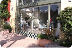
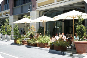
Orienting buildings toward the sidewalk edge will help to
engage pedestrians, and encourage walking and cycling. Providing sidewalk
space for retail, dining, and seating, especially in the area around
Northgate and along Merrydale Road provides interest and appeal.
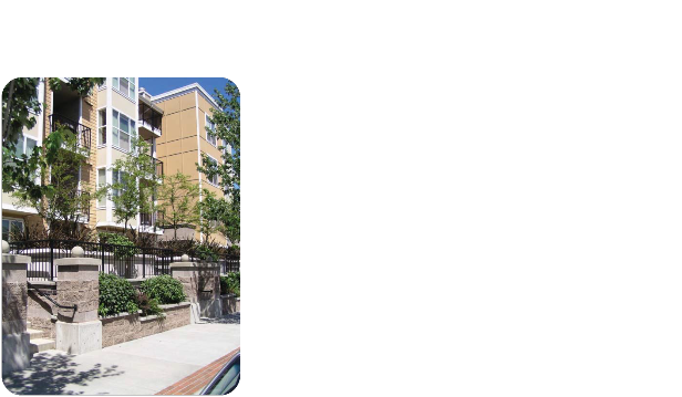
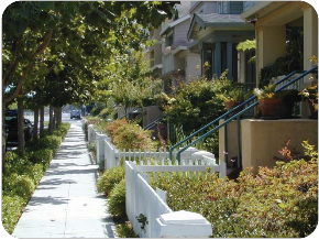
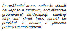
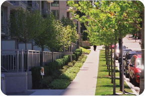
In residential areas, setbacks should be kept to a minimum,
and attractive ground-level landscaping, planting strip and street trees
should be provided to ensure a pleasant pedestrian environment.


5.12 SUMMARY OF RECOMMENDATIONS
The land use and urban design strategies recommended by this Plan both
support the community’s vision for a vibrant, mixed-use, transit-oriented
station area, and protect and enhance the existing neighborhoods.
1. Protect existing residential neighborhoods.
No changes are proposed for the existing single-family
residential neighborhoods. These neighborhoods should be protected from
adverse impacts of new development. New development should be both in scale
with the existing neighborhoods and complementary in community character.
2. Encourage residential uses within walking
distance (generally a ¼-mile) of the station.
Inclusion of additional multi-family residential development near the
station will help increase ridership for the transit station. Affordable
units will be included in this new housing throughout the Station Area
through conformance with existing and future City housing
policies.
3. Allow limited retail in proximity to the
station. Current market demand does not appear to be strong
enough to support significant additional retail in the area. However, some
additional station-serving and neighborhood-serving retail should be
allowed, though not required, in areas appropriate for mixed-use
development.
4. Develop design guidelines to ensure
compatibility with the existing neighborhoods.
Higher densities demand greater attention to high quality design, and
design guidelines can help ensure compatibility of new development with the
existing neighborhood character.
Design guidelines should reflect the unique character of each of the three
planning areas, based on the guidelines in this plan.
East of US 101 Area Design Guidelines should
be developed to preserve views, buffer single-family neighborhoods, and
support the City’s creeks and wetlands policies.
Redwood Highway Area Design Guidelines need
to address building height transitions, building façade articulation and
massing, and setbacks to ensure compatibility with the adjacent residential
neighborhoods.
Northgate Area Design Guidelines are needed
to buffer existing neighborhoods from the height increases of new
development.
5. Restore and enhance the natural resources in the
station area. The station area has an abundance of natural
open space, hillsides, creeks, and wetlands. These resources should be
restored and enhanced per the General Plan and zoning designations. They
should also be celebrated by new development.
• New development should celebrate natural resources.
• Restore and enhance the natural environment by improving and protecting
creeks, wetlands and hillsides as provided in the General Plan and zoning
provisions.
• The Intergovernmental Panel on Climate Change estimates that mean sea
level rise will rise between one and three feet by the end of this century.
A three-foot rise would inundate much of eastern and central San Rafael,
potentially impacting the study area. In accordance with the San Rafael
Climate Change Action Plan, the City will monitor sea level rise and plan
for shoreline defense; develop a program of levee analysis; participate in
Marin County’s regional vulnerability assessment, and prepare a local
vulnerability assessment for San Rafael; and continue to provide emergency
planning and community awareness.
6. Allow an increase in building height, allowable
FAR and/or residential density in focused locations. In addition, amend the
General Plan and zoning designations on Planned Development (PD) zoned
parcels to allow for additional uses. The increases in
density are contingent upon the identified limits of traffic capacity in the
area. They reflect the development potential of each of the three planning
areas. See Figures 18A/18B for height increases.
East of US 101 Area
• In the current office and commercial areas, investigate and implement
increases in retail and office FAR above
0.30 and increases in residential density above 44 units per acre within the identified limits of traffic
capacity. Amend the General Plan and zoning designations on PD zoned lots to
allow residential use.
• Density increases can be higher on the level lots (MCERA APN 180-410-06;
3900 Civic Center Drive parking APN
180-124-06), than on the more distant flat lots or on the hillside lots.
• The Christmas tree lot is under County
jurisdiction. If changes to the existing master plan are contemplated in the
future, density and FAR increases
to the same level as the (MCERA APN 180-410-06 and 3900 Civic Center Drive
parking APN 180-124-06), are
appropriate.
• Include requirements for facilitating pedestrian access to the Station
from the sites at higher elevations on the hillside.
• On development sites close to the station, amend the General Plan and
zoning to increase height limits to 4 stories for residential and
mixed-use development only, subject to design requirements. Allow an
additional story (for a total of 5) for developments that propose
a significant benefit or amenity in the planning area. Also, develop design
guidelines that specifically address:
o Preservation of views from the hillside
residences
o Establishment of view corridors along
Avenue of the Flags to the hills, Mt. Tam and the Frank Lloyd Wright
designed Civic Center
o Height step-backs and buffers from
single-family neighborhoods
o Continuation of the City’s creek and
wetlands policies.

74
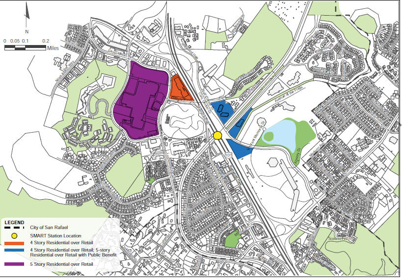
NO CHANGE ALTERNATIVE FIGURE 18A

STORY ALTERNATIVE FIGURE18
B
Redwood Highway Area
• On the properties closest to the station, specifically the Public
Storage and Marin Ventures sites, investigate and implement increases in
retail and office FAR above 0.30 and increases in residential density above
44 units per acre within the identified limits of traffic capacity. Amend
the PD zoning to allow a mix of residential and retail.

• Increase height limits on Redwood Highway to 4 stories where
residential is constructed over ground floor retail.
The Committee reached consensus on the Draft Plan to include the italicized
text above. After hearing the public comments on the Draft, the Committee
was not able to reach consensus on heights for the Redwood Highway frontage,
the Marin Ventures site, or either storage lot parcel, and were evenly
divided between a No Change Alternative and a Four-Story Alternative.
• Develop design guidelines for the Merrydale Road properties to include
height transitions, building articulation and varied setbacks to prevent the
appearance of a solid wall to the adjacent single-family neighborhood.
Northgate Area
• On the properties closest to the station, specifically the Northgate
Storage site and Northgate III, investigate and implement increases in
retail and office FAR above 0.30 and increases in residential density above
44 units per acre within the identified limits of traffic capacity.
• Amend the General Plan and zoning for Northgate III to increase densities
to the levels assigned to the areas within walking distance of the station,
and to allow 4 stories for residential over retail uses.
• Consider the extension of the Promenade through Northgate III in any major
reconstruction of the site.
• Develop design guidelines to buffer height increases from single family
neighborhoods.
• Amend the General Plan and zoning to allow height increases to 5 stories
for residential development at Northgate Mall.

77
| 